 Idaho ATV
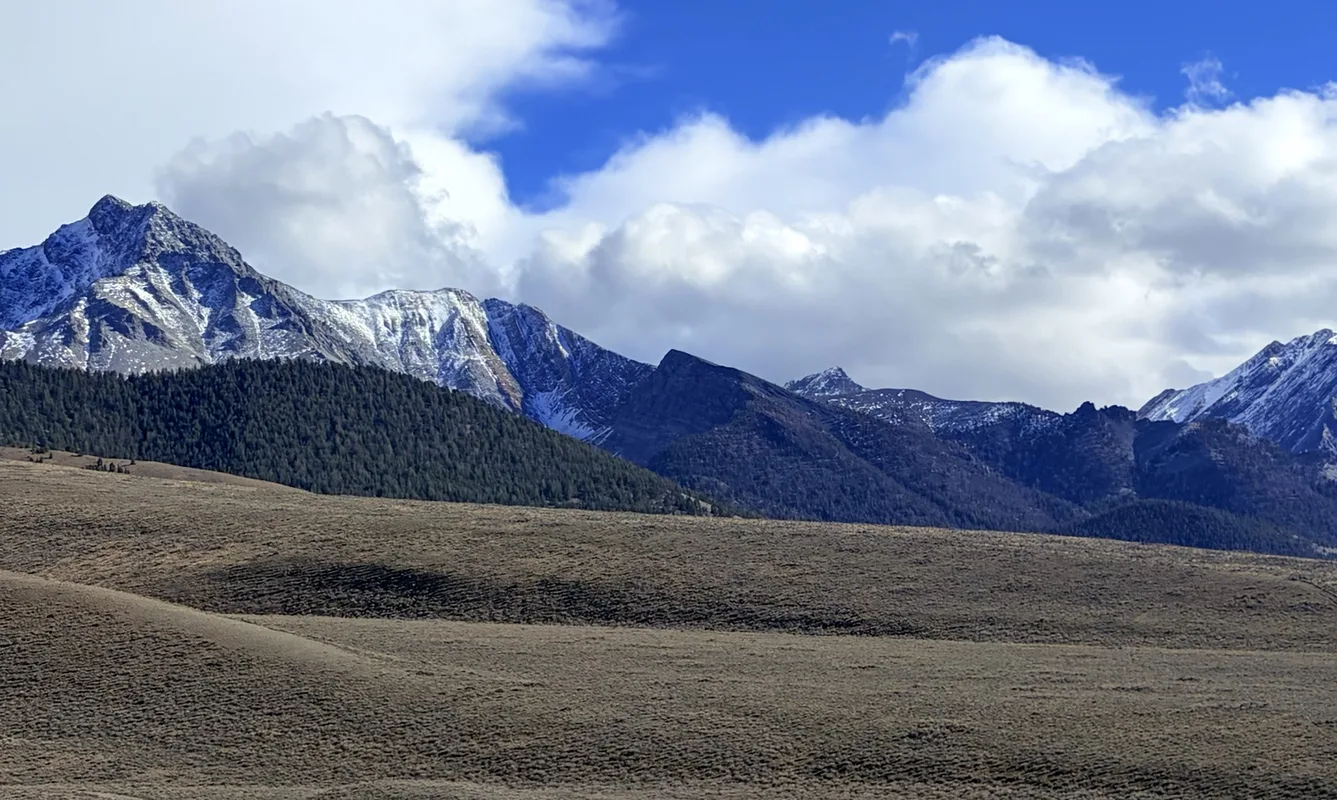
The Lost River Range from Doublespring Pass Road, north of Mackay. Photo: Jason Leue.
Mackay and the Lost River Valley ATV & UTV riding, rentals and rules
Mackay lets you drive an ATV or side-by-side on any city street or alley, and from town hundreds of miles of roads and trails run into the Big and Little Lost River valleys — starting with the BLM's Mackay Mine Hill Tour. Source: mackayidaho-city.com Source: blm.gov
Summer: Mine Hill sites can close without notice because of private mining — obey the signs. Source: visitidaho.org
Dec 16–Apr 30: BLM closes Birch Creek, Carlson Hills, Donkey Hills, Old Stage Road and Willow Creek Summit to motor vehicles. Source: blm.gov
- 1rental shop
- Everycity street open to ATVs and UTVs
- 3Mine Hill routes
ATV and UTV rentals for Mackay and the Lost River Valley
Cheapest first. Prices are each shop's own published rate, with the date we read it. Book directly with the shop.
-
Lost River Adventures
Mackay$285lowest published rateUTV rental- Driver age
- 21+
- Pickup
- 4255 N US Hwy 93, Mackay
- Phone
- 208-588-2733
- Checked
- 2026-11-16 · source
Visit Lost River AdventuresAll published rates (4)
- Enchanted Forest ride: $285 from, 4-9 hours
- Pass Creek Off-Road Tour: $293 from, 4-9 hours
- Mackay Mine Hill Off-Road Tour: $293 from, 4-9 hours
- Multi-day off-road rental: $336 per day
Where to ride
The Mine Hill Tour has three routes: Green (rough but maintained gravel, any vehicle), Blue (no low-clearance cars — rough, steep, narrow) and Red (ATVs, dirt bikes, bikes, horses and hikers only), which crosses the rebuilt Shay Railroad Trestle — single lane, no turnouts, under 50 inches wide. Source: blm.gov On the way: the 1917 aerial tramway and headhouse, the White Knob townsite (about 1,000 people at its peak, empty by the mid-1930s) and the Horseshoe Mine. Source: visitidaho.org Forest roads lead to Copper Basin (Road 138), Antelope Canyon (137), Pass Creek (122) and the North Fork of the Big Lost (128). Source: fs.usda.gov For ride-by-ride guides, see Borah Vista.
Rules on the ground
- Mackay's city map shows an unloading spot and routes to the trailheads. Source: mackayidaho-city.com
- On city and county roads you still need the restricted plate, driver's license and insurance.
- Wider side-by-sides only on designated 4x4 routes; the Motor Vehicle Use Map, not the signs, is the legal map. Source: fs.usda.gov
- Camp only at OHV staging areas and campgrounds, at least 100 feet off the trail. Source: fs.usda.gov
- Arco, down the valley, also lets ATVs on its streets, with exceptions. Source: cityofarco.municipalimpact.com
We state the rule and link the official source; we do not give legal advice. Check the source before you ride.
Trail repair & recovery
Camping
Joe T. Fallini Recreation Site on Mackay Reservoir, 6 miles north of town — 26 sites with full RV hookups, dump station, boat ramp, fee. Source: blm.gov
Forest campgrounds include Iron Bog, Star Hope and Phi Kappa ($10 a night). Source: fs.usda.gov
Maps and who to call
Lost River Ranger District, 716 W Custer, Mackay — 208-588-3400 · BLM Challis Field Office — (208) 879-6200 · City of Mackay (Mon–Thu). BLM Mackay Mine Hill Tour map (2021). Source: fs.usda.gov
Every national forest's Motor Vehicle Use Map is the legal map of which roads and trails are open to which vehicles. Visitors need the Idaho nonresident OHV sticker — see the rules.
Questions
Can you drive an ATV on the streets in Mackay?
Yes — the City of Mackay allows ATVs, side-by-sides and UTVs on any city street or alley. State road rules still apply.
Can a full-size side-by-side ride the Mine Hill Red Route?
No — the Shay Trestle is under 50 inches wide.
How this page is made
Every fact is from the Forest Service, the BLM, Idaho Parks and Recreation, the county or the chamber named beside it, read on 2026-11-16. Seasonal closures change every year — check the agency before you go.
Riding near Mackay, Challis or Stanley? Tell us the trip.
Your dates, your group, your budget. Our sister site Borah Vista will email you a plan and pass your request to local rental shops and places to stay. Free, and you still book directly with them.
Plan my trip